

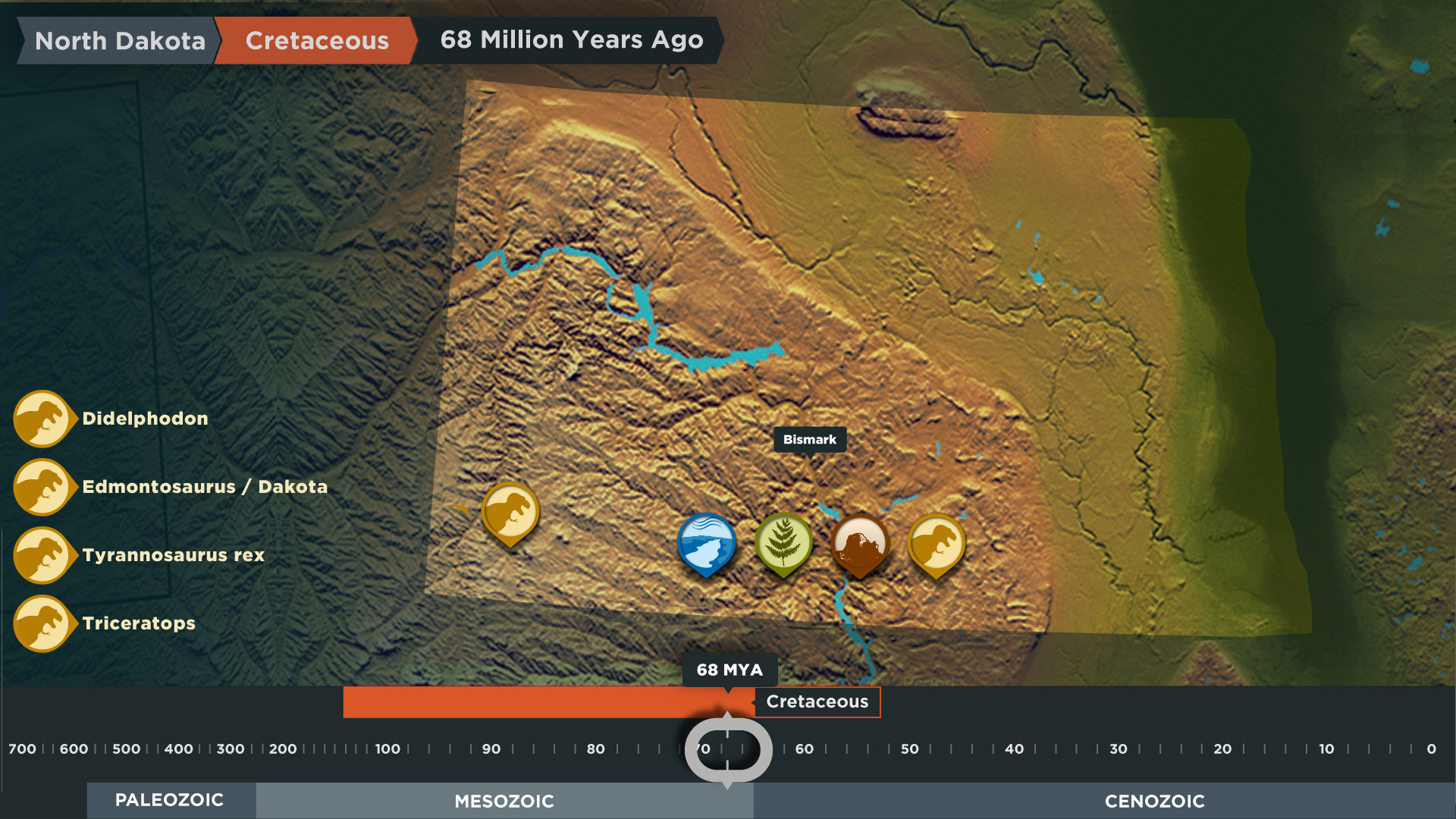
The Timeline Touch table is a visual encyclopedia of North Dakota timeline from 600 million years ago to present day.


TIMELINE
The Timeline Touch table is the gallery’s visual encyclopedia, spread out over a timeline from 600 million years ago to present day. As users move along the timeline, the underlying landscape changes to reflect the morphology of the region while location and time-relevant hotspots appear inviting users to explore the information in more detail.
Who knew that much of North America was covered in a warm and shallow sea called Lake Agassiz?

PROJECTION
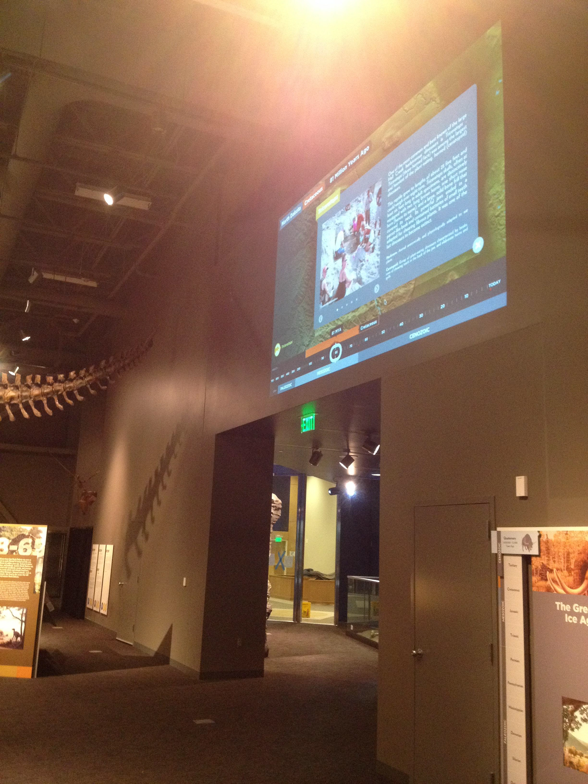
The timeline has a projection option to share the content during presentations and talks to larger groups.
GEOLOGIC TIMESCALE ANIMATION
The below geologic timescale indicates the approximate location of the present day North Dakota land area throughout the ages.
